This blog follows Wayne Andresen on a fully supported 52 day coast to coast bicycle ride from the Pacific Ocean at San Diego, California, to the Atlantic Ocean at St. Augustine, Florida.

Saturday, March 12, 2016

Day 8: Saturday 03/12/16, Casa Grande, AZ to Catalina State Park (Tucson), AZ

Day 8 distance:  62 miles

Total miles:  471 miles

Elevation Gain:  1664 feet

Map of today's ride:


When I rode the first 29 days of last year's C2C ride before my accident, I considered the ride between Casa Grande and Catalina State Park to be my hardest physical day of the 29 days. It probably was due to several factors, but the one I remember the most was the strong head winds encountered while riding to the SE between Casa Grande and Tangerine Road, the bulk of the day's ride direction. That, followed by the long but gradual grade up Tangerine Road was extremely exhausting. One year later, the same ride over the identical roads was just the opposite. We did not have the headwinds and for most of the ride only a very light crosswind. The crosswind got stronger right before Tangerine Road which was to our advantage as the wind was then at our backs and helped push us up the Tangerine Road grade. All in all, today's conditions were ideal and the Dairy Queen cone I had at Pacacho at 9:30 am apparently provided all the energy I needed to finish the ride with energy to spare!

This picture was taken about 8 miles south of Casa Grande looking at Pacacho Peak in Pacacho Peak State Park, about 18 miles ahead. Note the two coasters riding ahead on the wide shoulder of the road, 

We rode through a pecan orchard between the towns of Eloy and Pacacho.

Roadside view a couple miles east of Pacacho Peak State Park.

Pacacho Peak as it appears looking at it to the SW.

Looking to the east a short distance south of Pacacho Peak, you can see the Pinal Airpark Airport, where up to 400 Commercial and government airplanes are stored in an airplane "boneyard." The dry, low humidity of the Sonoran Desert provides an ideal storage environment.

Picture of farmland taken at our last SAG stop of the day in Marana, Arizona.

Picture of the Tortolita Mountains about 20 miles north of downtown Tucson.

A beautiful Saquaro cactus along Tangerine Road. This is a very old Saquaro as it takes up to 50 years before the first "arm" will begin to grow.

What are the odds that a bicycle ride from coast to coast will go right by one of the gates to the community your blogger resides in the winter months? The really nice part is that I get to spend two nights in my own bed since tomorrow is our first day off from riding almost 500 miles over the eight days it took us to get to this point from San Diego!

My wife Cheryl, neighbors and Rotary friends who met me as I passed by our community. What a great welcome! Thank you all for taking the time to wait for me to bicycle past!

Our first good view of the Catalina Mountains which rise above Catalina State Park, our next two day's camping site.

Goal reached!

A few of the tents set up for the two day stay.

LINK to Day 8 of my 2015 C2C blog.
*******************


Friday, March 11, 2016

Day 7: Friday 03/11/16, Gila Bend, AZ to Casa Grande, AZ

Day 7 distance:  82 miles

Total miles:  408.5 miles

Elevation Gain:  1379 feet

Map of today's ride:


Today's ride of 82 miles from Gila Bend to Casa Grande was the longest of the last 7 days. The day was overcast for the most part with intermittent periods of sunshine, and although the day started cool, by the time we arrived in Casa Grande the temperature had reached the mid 80's. I was drinking a water bottle every 10 miles for the final 50 miles and still became slightly dehydrated. The first 20 miles of the ride today was up a slight but steady 0.4 - 1.7% grade. Not very steep, but the grade and wind did impact my speed by about 3-4 mph. Shortly before arriving at our motel tonight, the wind got very strong as can be seen in one of the following pictures. All in all, I guess the final analysis would be that this was a typical day of bicycling!

Today's ride took us through the natural desert to beautiful looking agricultural crops on an irrigated desert. We also passed several extremely large cattle and dairy operations. In between the desert and agricultural area, we passed through the city of Maricopa, Arizona, the 18th largest city in Arizona with a population just under 50,000. The area is famous because in the 1950's, John Wayne owned a 50,000 acre ranch close to it, and at one point had a feedlot that supported up to 85,000 head of beef.

The day through pictures:

A typical desert scene for the first 30 miles today.

The large sand hill in the background with the two black rectangles on it is actually one of several landfills along AZ-238 that is operated by cities in the Phoenix area.
This picture was taken along highway SR-347 just south of Maricopa, Arizona. Note the large overhead sprinkler in the beautiful green alfalfa field.  
I stopped this individual along SR-347 and chatted with him for a few minutes. I thought he might be a fine addition to Bubba's coasters until I found out he was a local just out for a ride. :)
Arizona highway SR-347 was very nice to ride because of a very wide shoulder, and for the most part, it was very smooth.
Perhaps a business opportunity at the corner of SR-347 and AZ-84E.
This dairy along AZ-84E is simply amazing in size. The cattle continued for over 2 miles and I believe these Holsteins ranged in age from milking cow to heifers. They were in separate fenced areas by age. It would be interesting to know the number of the gallons of milk produced each day from this operation.
I don't know how far it was to the back of the pens, but like stated in the preceding picture, this continued for over two miles!
I chatted with these two young ladies on their beautiful horses for a short time. I didn't get their names but the one on the Palomino said she lived a short distance away and performs in rodeos.  I should have taken more time to learn more about them. At least I should have taken enough time to allow the dust raised by the horses to settle before I snapped the picture! 
This picture was taken on the south side of Casa Grande about 3 miles from the motel we are staying the night. It got very windy and was still windy this evening. We all are hoping the wind settles down before we ride tomorrow to Catalina State Park in Tucson.
The motel we are staying at tonight was not ready for us, so many coasters had to wait a long time for their rooms. Not sure what Eddo in the front chair did with his clothes, but he sure did look comfortable in the heat!


Tomorrow's ride to Catalina State Park is 62 miles long. We are all hoping that the wind will not be in our face like it was last year!


LINK to Day 7 of my 2015 C2C blog.


Thursday, March 10, 2016

Day 6: Thursday, 3/10/16, Dateland, AZ to Gila Bend, AZ

Day 6 distance:  52 miles

Total miles:  326.5 miles

Elevation Gain:  760 feet

Map of today's ride:


There was a pretty sunset last night in Dateland but it came too late to make yesterday's blog, so I am including it today:

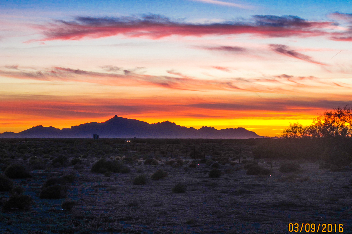
Sunset at Dateland, Arizona on March 9, 2016.
Today's ride was almost a repeat of yesterday, with the only difference being it was about 19 miles shorter at 52 miles. We woke up this morning to a temperature of 50 degrees so arm warmers were worn for about the first 15 miles while the sun warmed the air. After that, is was short sleeves and a lot of water consumed to stay hydrated. Currently in Gila Bend, our day's destination, it is 86 degrees at 2:20 pm. We are staying at a KOA Campground tonight that has a large air conditioned activity center with a TV, pool table, and tables that we will be seated for dinner (meat loaf). By the time we go to bed (around 9 pm) our tents will be cool enough for sleeping. And by midnight, long johns, a long sleeved top and stocking cap will be on my head, as it really cools down on the desert at night!

Today we rode for 35 miles on the shoulder of Interstate 8. It is legal to ride on the shoulder when there are no alternative parallel roads, which is usually the case when riding across vast expanses of deserts. Today more time was spent on the interstate than will be for the entire remainder of the C2C ride. I don't mind riding on the interstate as I believe it is much safer than many of the shouldered secondary roads we travel. The traffic is only going one direction in wide lanes, and there is a rumble strip to warn drivers and bicyclists if a car is entering the shoulder. However, there is a downside, and that is  the high speed noise of continual traffic passing does wear on one's nerves.

Because we did spend so much time riding in the desert today, I only took two pictures as more would just be a repeat of the same thing:

This picture was taken from our first SAG stop at a Rest Area on I-8, about 17 miles east of Dateland.

These are the first Saquaro cactus I have observed on this trip. In the days ahead, they will become much more common.   
Since today's blog is short, I will add a couple miscellaneous pictures: 

Two fellow coasters standing in front of the welcoming sign at the city limits of Gila Bend. On the left is Kurt Frederick from Milwaukee, Wisconsin, and on the right is John Ilenin from North Olmsted, Ohio. Note on the welcome sign behind Kurt and John, it states there are 1917 friendly people in Gila Bend and 5 Old Crabs  ("Crabs" is hidden behind Kurt.) The interesting part is that on the blue square below the "And 5" are the names of the 5 crabs.
 
This is Margie Skaggs, our traveling massage therapist from Louisville, Kentucky. She has been with Bubba since 2012.  Not only is Margie a great massage therapist, but she is also a great hugger! 


Tomorrow we will ride 81 miles from Gila Bend to Casa Grande, Arizona. Our longest ride to date.

LINK to Day 5 of my 2015 C2C blog.

Wednesday, March 9, 2016

Day 5: Wednesday 3/09/16, Yuma, AZ to Dateland, AZ

Day 5 distance:  71 miles

Total miles:  272 miles

Elevation Gain:  1049 feet

Map of today's ride:

Today was another great day of riding! We left Yuma this morning with blue skies and a temperature of around 50 degrees. Early this afternoon when we arrived in Dateland, my phone said the local temperature was 80 degrees. Even better, we had a mild tail wind throughout the ride.

The ride was uneventful for most riders, although one rider caught her husband's rear wheel in a wind gust and tipped over. She cracked her helmet when she hit the concrete of the freeway, but says she feels fine although a little sore. Another rider's rear derailleur hangar broke on a one year old electronic shift bicycle. Fortunately, he had a spare derailleur hangar in his spare parts bag, so the bicycle was repaired this evening and is ready for tomorrow. He was given a SAG support member's bicycle to ride the rest of today so did not lose an inch of his C2C ride.

We are tent camping in Dateland, Arizona tonight. Most riders stopped at the local travel center to try their famous Date and Cactus milk shakes. Most liked what they tried, but I didn't hear of anyone trying to obtain the recipes so they could make them at home! I am still undecided if I will walk over for a milkshake after dinner, but since I have tried both kinds in the past, my choice if I do go would be a good old chocolate shake!

Tomorrow we will ride 52 miles to Gila Bend, AZ. The Gila Bend weather forecast is looking good with a low of 52 tonight and a high of 84 degrees tomorrow.

Today's pictures:

Beautiful morning as we head away from the Yuma National Guard Armory where we spent the night.

The scenery was beautiful for most of today's ride. This scene was about ten miles out of Yuma, shortly before entering Dome Valley, the "Salad Bowl" of America.

This is representative of the farmer's homes in Dome Valley. It appears that farming salad ingredients is a profitable venture!

For a considerable distance and depth along side the Dove Valley road, this farmer was growing something protected from the the elements and animals. I don't know what the crop was (strawberries?), but if one of the readers of this blog knows, please leave a comment so we will all know.

This individual was flood irrigating a field planted with some vegetable. He did not understand English, but understood the camera and posed for the picture. I always ask the person if it he will agree to be photographed.

These workers were harvesting cabbages.

This is the bicycle that experienced the broken derailleur today. The broken derailleur is being held up from the ground by the chain.

This individual was riding in the ditch alongside the road next to a field of cabbages. I do not know why the shotgun was hanging on the bicycle, but it does makes a good case for asking permission before taking someone's photo!

Some coasters riding through Dome Valley.


A pretty scene as we were exiting Dove Valley.

This roadside diner in Tacna, Arizona is closed on Wednesday, but opens up each year to serve lunch to Bubba's riders when they pass by. The food is top notch, but better yet, is the fact that the diner should be on the list of the Historical Register. The inside is like traveling back in time but is exceptionally clean and in like-original condition. A spot to stop if ever traveling down Interstate 8 to or from San Diego.

Pretty flowers with a pretty mountain in the background. Located off I-8 about 15 miles before Dateline.
Link to day 5 of my 2015 C2C blog.

Tuesday, March 8, 2016

Day 04: Tuesday 3/08/16, Calexico, CA to Yuma, AZ

Day 4 distance: 65.5 miles

Total miles: 202.5 miles

Elevation Gain: 1113 feet

Map of today's ride:


Unknown planting about 10 miles east of Calexico, California.
I started today's blog with the picture above to show you what a beautiful day we had today! We woke up to blue sky and much warmer temperatures which reached 76 degrees by the time I arrived in Yuma, Arizona. It was very nice to be able to bicycle in normal temperatures for this area for this time of year, and we all have already forgotten about the last two days fighting of cold, rain, sleet, and high winds!

The 65 mile ride today was very pleasant and mainly uneventful. For most of the ride we had a good tailwind to make the ride even more pleasant. The only issue we faced were some very rough roads. The first section of extremely bumpy road was along most of a 20 mile stretch on the shoulder of Interstate 8. About every 8 to 10 feet, the road's shoulder was split open as wide as 4-5 inches with lips projecting upwards on both sides of the split a couple inches high. Then, about 20 miles from Yuma, we rode a 4.5 mile stretch of Araz Road which was full of cracks and pot holes. For most of that section of the ride, speeds were limited speeds to just a few miles per hour. The following is a picture taken of the Araz Road surface. Of course on any long ride one should expect sections of rough roads so one just accepts it and rides on!

Road surface of Araz Road, 20 miles from the end of today's ride. 

Following are a few miscellaneous pictures from today's ride:

Fellow Coaster Tom Coe looking at a crop of corn that had just been flood irrigated near Calexico.


Interstate 8 crosses the All-American Canal near Yuma. This is the life blood of the desert.

The Imperial Dunes Recreational Area as seen from Interstate 8.

The Church of Felicity at Felicity, California, also where the Center of the Earth has been legally declared.

A twenty foot section from the Eiffel Tower, now located in Felicity, California. It was purchased in 1989 when the original stairway was replaced. This monument is called "The Stairway to Heaven."

This driver was driving on the dry Colorado River at the border between California and Arizona at Yuma. The back end of his pickup apparently sunk in the sand.  It looked like he had a hole dug in the sand about 2 feet deep by one back wheel, but the effort was looking hopeless.

I was riding alone as I entered Arizona so I had an opportunity to try out the selfie stick I bought for the ride. The stick worked although it appears the picture taker did not want his picture taken. :)  Also note that my name on the vest is not only for strangers but also comes in handy for me once in a while.

I was cramp free last night so I am assuming that my normal early ride cramp episode is behind us just like the bad weather!


LINK to Day 4 of my 2015 C2C blog.